Map

The Axe Brue, Parrett & North Somerset Levels interactive map will open in a new page by clicking the link. You will be able to zoom in and view watercourse and structure names throughout the Drainage Board districts.
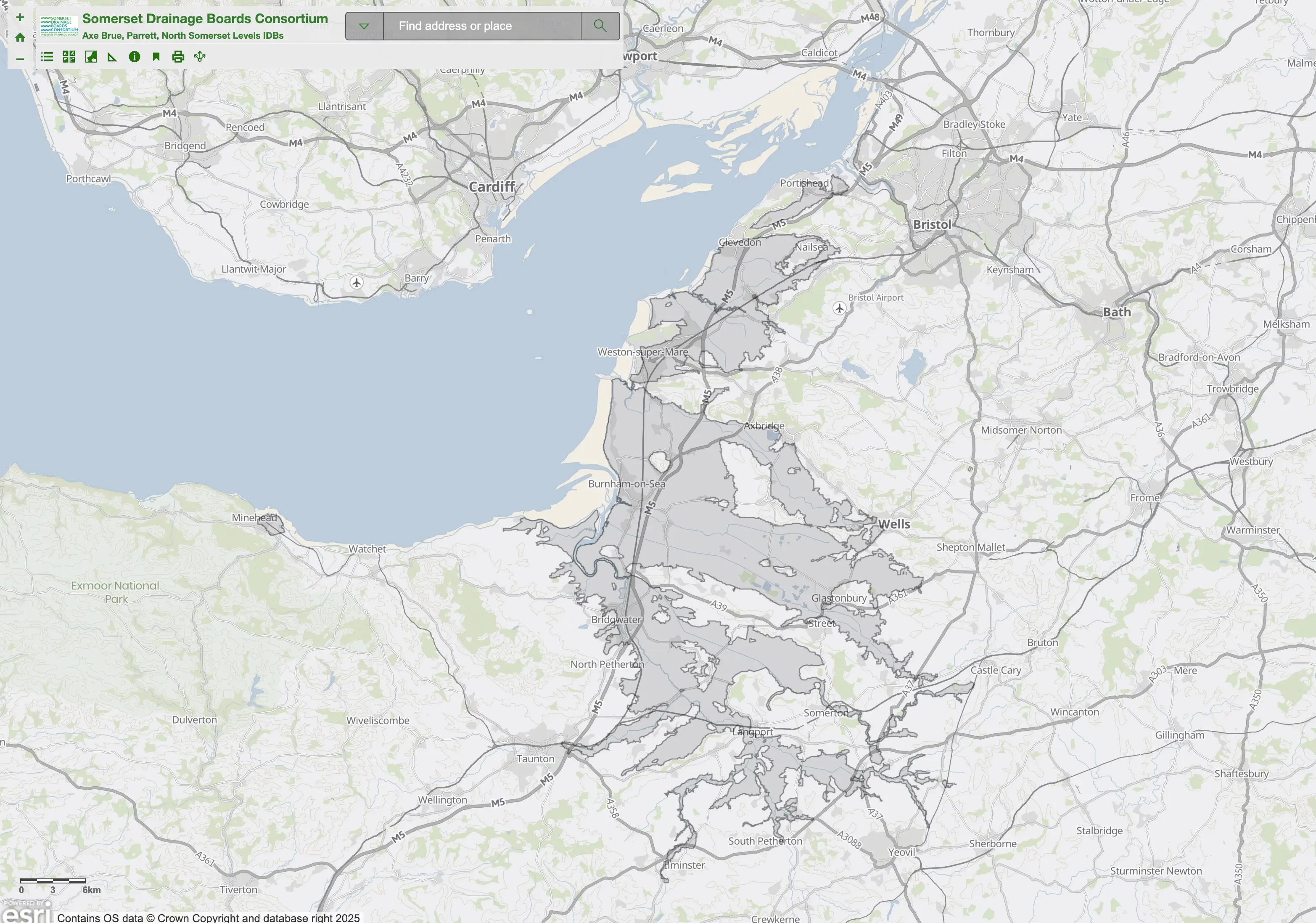
If you wish to report an issue with a watercourse or structure within the Drainage Board district, use the map to identify the locality and name/s, then call the office on 01278 789906 with the information.
Please note: All maps are indicative only. IDB infrastructure and asset information may be subject to change at any time. Assets included shown form part of the water level management infrastructure within the Drainage Boards Districts and are subject to Byelaws pursuant to Section 66 of the Land Drainage Act 1991. IDB ownership of any asset is neither confirmed nor implied by virtue of inclusion within the map and ownership of any asset should be confirmed with the IDB if required. All water control structures may not be shown. Should you require more detailed information please contact the office on 01278 789906.